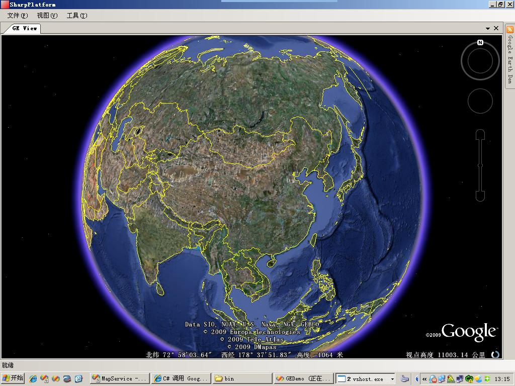
好久沒有更新《C#調用Google Earth Com API開發》系列文章了,今天帶給大家的是第三篇,本篇相 對於第二篇主要改進了三個方面。
1) 實現GoogleEarth顯示畫面隨窗口大小改變而改變
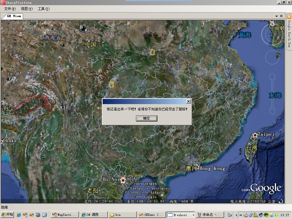
2) 截獲GoogleEarth鼠標消息,實現單擊、雙擊功能;鼠標滾輪縮放現在只能放大!O(∩_∩)O~
3) 實現GoogleEarth彩色截圖(測試環境:Windows 2003 Server ,Vista與Win7中不可用,XP未測)
下面還是繼續看代碼:
1、GoogleEarth動態改變大小
1: /// <summary>

2: /// 重新改變GoogleEarth視圖的大小

3: /// </summary>

4: private void ResizeGoogleControl()

5: {

6:   NativeMethods.SendMessage(GEHWnd, (uint)NativeMethods.WM_COMMAND,  NativeMethods.WM_PAINT, 0);

7:   NativeMethods.PostMessage(GEHWnd, NativeMethods.WM_QT_PAINT, 0, 0);

8:

9:   RECT mainRect = new RECT();

10:   NativeMethods.GetWindowRect(GEHWnd, out mainRect);

11:   clientRect = new RECT();

12:   NativeMethods.GetClientRect(GEHrender, out clientRect);

13:

14:   int offsetW = mainRect.Width - clientRect.Width;

15:   int offsetH = mainRect.Height - clientRect.Height;

16:

17:   int newWidth = this.Control.Width + (int)offsetW;

18:   int newHeight = this.Control.Height + (int)offsetH;

19:

20:   NativeMethods.SetWindowPos(GEHWnd, NativeMethods.HWND_TOP,

21:     0, 0, newWidth, newHeight,

22:     NativeMethods.SWP_FRAMECHANGED);

23:

24:   NativeMethods.SendMessage(GEHWnd, (uint)NativeMethods.WM_COMMAND,  NativeMethods.WM_SIZE, 0);

25: }
2、鼠標消息
此例子中對於鼠標消息到處理使用了鉤子,調用HookAPI.dll實現。
1:     /// <summary>

2:     /// 鼠標鉤子

3:     /// </summary>

4:     private MouseHook mouseHook;

5:

6:     // 設置鼠標鉤子

7:     mouseHook = new MouseHook();

8:     mouseHook.MouseClick += new MouseEventHandler (mouseHook_MouseClick);

9:     mouseHook.MouseDbClick += new MouseEventHandler (mouseHook_MouseDbClick);

10:     mouseHook.MouseWheel += new MouseEventHandler (mouseHook_MouseWheel);

11:     // 啟動鼠標鉤子

12:     mouseHook.StartHook(HookType.WH_MOUSE_LL, 0);
單擊事件:
1: /// <summary>

2: /// 鼠標鉤子。鼠標單擊事件

3: /// </summary>

4: /// <param name="sender"></param>

5: /// <param name="e"></param>

6: void mouseHook_MouseClick(object sender, MouseEventArgs e)

7: {

8:   IntPtr hWnd = NativeMethods.WindowFromPoint(e.Location);

9:   if (hWnd == this.GeRenderHWnd)

10:   {

11:     Point point = this.Control.PointToClient(e.Location);

12:     // 如果鼠標擊點位置在控件內部,則說明鼠標點擊了GoogleEarth視圖

13:     if (this.Control.ClientRectangle.Contains(point))

14:     {

15:       Console.WriteLine("點擊了GoogleEarth...");

16:

17:       DoublePoint dp = ((GERenderPanel)Control).DetermineScreenCoordinates (point.X, point.Y);

18:

19:       ParameterizedThreadStart pts = new ParameterizedThreadStart (ShowMouseClickPoint);

20:

21:       Thread thread = new Thread(pts);

22:       thread.Start(dp);

23:

24:     }

25:   }

26: }

27:

28: protected void ShowMouseClickPoint(object obj)

29: {

30:   //Thread.Sleep(20);

31:   DoublePoint dp = (DoublePoint)obj;

32:   PointOnTerrainGE pGe = GeApp.GetPointOnTerrainFromScreenCoords(dp.X,  dp.Y);

33:   Console.WriteLine("鼠標點擊了:Lnt=" + pGe.Longitude.ToString()

34:     + ";Lat=" + pGe.Latitude.ToString());

35: }
雙擊事件:
1: /// <summary>

2: /// 鼠標鉤子。鼠標雙擊事件

3: /// </summary>

4: /// <param name="sender"></param>

5: /// <param name="e"></param>

6: void mouseHook_MouseDbClick(object sender, MouseEventArgs e)

7: {

8:   IntPtr hWnd = NativeMethods.WindowFromPoint(e.Location);

9:   if (hWnd == this.GeRenderHWnd)

10:   {

11:     Point point = this.Control.PointToClient(e.Location);

12:     // 如果鼠標擊點位置在控件內部,則說明鼠標點擊了GoogleEarth視圖

13:     if (this.Control.ClientRectangle.Contains(point))

14:     {

15:       Console.WriteLine("xx雙擊了GoogleEarth...");

16:

17:       DoublePoint dp = ((GERenderPanel) Control).DetermineScreenCoordinates(point.X, point.Y);

18:

19:       ParameterizedThreadStart pts = new ParameterizedThreadStart (ShowMouseDbClickPoint);

20:

21:       Thread thread = new Thread(pts);

22:       thread.Start(dp);

23:

24:     }

25:   }

26: }

27:

28: protected void ShowMouseDbClickPoint(object obj)

29: {

30:   //Thread.Sleep(20);

31:   DoublePoint dp = (DoublePoint)obj;

32:   PointOnTerrainGE pGe = GeApp.GetPointOnTerrainFromScreenCoords(dp.X,  dp.Y);

33:   Console.WriteLine("xx鼠標雙擊了:Lnt=" + pGe.Longitude.ToString()

34:     + ";Lat=" + pGe.Latitude.ToString());

35:

36:   MessageBox.Show("我還是出來一下吧!省得你不知道你已經雙擊了鼠標!");

37: }
這兩處代碼還比較簡陋,比如未添加主窗口焦點檢測,相信讀者可以自行添加。O(∩_∩)O~
3、截圖
程序中有兩種截圖功能,一種是GoogleEarth自帶的截圖功能,只能截取黑白圖片;另一種為彩色截圖 ,但是Vista以上操作系統不支持,還未找到合適的方法實現Vista與Win7兼容。
1) GoogleEarth自帶截圖功能:
1: GEViewContent view = GetGEView();

2:

3: if (view != null)

4: {

5:   ApplicationGE ge = view.GeApplication;

6:   if (ge != null && ge.IsInitialized() > 0)

7:   {

8:     using (SaveFileDialog sfd = new SaveFileDialog())

9:     {

10:       sfd.Filter = "jpg圖片|*.jpg";

11:       sfd.AddExtension = true;

12:       sfd.CheckPathExists = true;

13:       sfd.Title = "保存Google Earth截圖";

14:

15:       if (sfd.ShowDialog() == DialogResult.OK)

16:       {

17:         ge.SaveScreenShot(sfd.FileName, 100);

18:       }

19:     }

20:   }

21: }
2) 彩色截圖:
1: GEViewContent view = GetGEView();

2: if (view != null)

3: {

4:   int nWidth = view.Control.Width;

5:   int nHeight = view.Control.Height;

6:   Point pt = view.Control.PointToScreen(view.Control.Location);

7:   int nXSrc = pt.X;

8:   int nYSrc = pt.Y;

9:

10:   IntPtr hRender = view.GeRenderHWnd;

11:

12:   if (hRender != IntPtr.Zero)

13:   {

14:     // 取得Render DC

15:     IntPtr hRenderDC = NativeMethods.GetWindowDC(hRender);

16:     // 創建hBitmap

17:     IntPtr hBitmap = NativeMethods.CreateCompatibleBitmap(hRenderDC,  nWidth, nHeight);

18:     // 創建MEM DC

19:     IntPtr hMemDC = NativeMethods.CreateCompatibleDC(hRenderDC);

20:     // 將Bitmap Select到MemDC

21:     NativeMethods.SelectObject(hMemDC, hBitmap);

22:     // 直接拷屏

23:     NativeMethods.BitBlt(hMemDC, 0, 0, nWidth, nHeight,

24:       hRenderDC, 0, 0, 13369376);

25:

26:     using(Bitmap bmp = Bitmap.FromHbitmap(hBitmap))

27:     {

28:       using(SaveFileDialog sfd = new SaveFileDialog())

29:       {

30:         sfd.Filter = "JPG圖片|*.jpg|PNG圖片|*.png";

31:         sfd.AddExtension = true;

32:         sfd.CheckPathExists = true;

33:         sfd.Title = "保存Google Earth截圖";

34:

35:         if (sfd.ShowDialog() == DialogResult.OK)

36:         {

37:           ImageFormat imgFormat = null;

38:           // 默認選擇JPG

39:           if (sfd.FilterIndex == 0)

40:           {

41:             imgFormat = ImageFormat.Jpeg;

42:           }

43:           // 選擇PNG

44:           else

45:           {

46:             imgFormat = ImageFormat.Png;

47:           }

48:           bmp.Save(sfd.FileName, imgFormat);

49:         }

50:       }

51:

52:       //銷毀資源

53:       NativeMethods.DeleteDC(hRenderDC);

54:       NativeMethods.DeleteDC(hMemDC);

55:     }

56:   }
OK,這篇GE開發到此為止,請讀者繼續等待後面的精彩文章…
不好意思,剛才忘記上傳源程序了!
http://files.cnblogs.com/wpwen/GEDemo_2009-05-22.rar