ArCGIs Server開發方式主要是利用本地的AO支持類庫對遠程MapServer進行連接,並通過取得的IMapServer遠程服務器接口取得上下文描述,調用遠程服務器上的AO控件來實現各種功能。因此本種開發模式需要有一台安裝有ArCGIs Server的服務器為開發提供MapServer支持。在ArCGIs Server上發布了相關的MapServer資源後,便可以對該MapServer資源服務進行開發。
開發機上需要安裝Visual Studio 2005軟件開發平台。
本種實現方式整體上與基於WebService方式有點類似,但是在接口實現上由於調用的AO接口不同,也會存在很大的差異,在下面實例中可以看到
ArCGIs Server開發方式主要是依靠服務器提供的MapServer服務來實現功能,因此需要有一台安裝有ArCGIs Server的服務器為開發提供支持。在ArCGIs Server上發布了相關的MapServer資源後,便可以對該WebService服務進行開發。
開發機上需要安裝Visual Studio 2005軟件開發平台。
ArCGIs Server的基本開發方式是首先連接ArCGIs Server服務器上的某一個的MapServer服務。在找到服務並建立了連接以後,在取得這個MapServer的上下文描述。然後根據取得的上下文描述獲取到這個MapServer的IMapServerAO接口。在獲取的ImaoServer接口的基礎上,利用上下文描述創建的多種接口,使用與WebService類似的實現方式,實現地圖操作和浏覽功能
打開VS2005,新建一個工程。工程名為:FzSecurityGisProxy
根據上面基於WebService例程建立類似的程序框架。
在進行程序編寫的時候,首先需要建立與遠程MapServer的連接,代碼如下:
public ESRI.ArCGIS.Carto.IMapServer getMapServer()
{
ServerConnection pServerConn = new ESRI.ArCGIS.Server.WebControls.ServerConnection("zhouj");//連接遠程服務器
pServerConn.Connect();
IServerObjectManager pSOM = pServerConn.ServerObjectManager;
pSC = pSOM.CreateServerContext("fuzhou", "MapServer");//建立連接以後,根據本連接建立上下文描述
IServerObject pSO = pSC.ServerObject;
IMapServer pMapServer = (IMapServer)pSO;
map = pMapServer;
return pMapServer;
}
MapServerInfo則為取得的服務基本描述,在其中包含了大量的GISMap服務的基本信息。如果需要取得服務的圖層信息,取圖層有根據系統的需要基本有兩種方式。
1、讀取所有的圖層,並將其添加到相關的圖層顯示控件中。
public void AddLayToTree(TreeView m_TreeVIEw)
{
String m_sDataFrame = map.DefaultMapName;
ESRI.ArCGIS.Carto.IMapDescription pMapDescription;
ESRI.ArCGIS.Carto.IMapServerInfo mapi = map.GetServerInfo(m_sDataFrame);
pMapDescription = m_sMapDesc;
int m = 0;
m_TreeVIEw.Nodes.Clear();
TreeNode[] m_tree;
for (int n = 0; n < mapi.MapLayerInfos.Count; n++)
{
if (mapi.MapLayerInfos.get_Element(n).ParentLayerID == -1)
{
m_TreeVIEw.Nodes.Add(mapi.MapLayerInfos.get_Element(n).ID.ToString(), mapi.MapLayerInfos.get_Element(n).Name);
m_TreeVIEw.Nodes[m].Checked = pMapDescription.LayerDescriptions.get_Element(n).Visible;
m = m + 1;
}
else
{
if (mapi.MapLayerInfos.get_Element(n).Type == "Group Layer")
{
m_tree = m_TreeVIEw.Nodes.Find(mapi.MapLayerInfos.get_Element(n).ParentLayerID.ToString(), true);
m_tree[0].Nodes.Add(mapi.MapLayerInfos.get_Element(n).ID.ToString(), mapi.MapLayerInfos.get_Element(n).Name);
m_tree[0].Nodes[m_tree[0].Nodes.Count - 1].Checked = pMapDescription.LayerDescriptions.get_Element(n).Visible;
}
else
{
m_tree = m_TreeVIEw.Nodes.Find(mapi.MapLayerInfos.get_Element(n).ParentLayerID.ToString(), true);
m_tree[0].Nodes.Add(mapi.MapLayerInfos.get_Element(n).Name);
m_tree[0].Nodes[m_tree[0].Nodes.Count - 1].Checked = pMapDescription.LayerDescriptions.get_Element(n).Visible;
}
}
}
}
2、將某些特征圖層根據需要添加到某個控件中,本實例中是將Feature圖層添加到ComboBox控件中,並根據選擇能將圖層表中的各個字段添加到控件中:
public void AddLayerToComb(ComboBox m_Comb)
{
String m_sDataFrame = map.DefaultMapName;
ESRI.ArCGIS.Carto.IMapDescription pMapDescription;
ESRI.ArCGIS.Carto.IMapServerInfo mapi = map.GetServerInfo(m_sDataFrame);
; pMapDescription = mapi.DefaultMapDescription;
for (int n = 0; n < mapi.MapLayerInfos.Count; n++)
{
if (mapi.MapLayerInfos.get_Element(n).Type == "Feature Layer")
m_Comb.Items.Add(mapi.MapLayerInfos.get_Element(n).Name);
}
}
public void AddColumnToComb(String LayerName, ComboBox m_Comb)
{
String m_sDataFrame = map.DefaultMapName ;
ESRI.ArCGIS.Carto.IMapServerInfo mapi = map.GetServerInfo(m_sDataFrame);
m_Comb.Items.Clear();
m_Comb.Enabled = true;
for (int i = 0; i < mapi.MapLayerInfos.Count ; i++)
{
if (mapi.MapLayerInfos.get_Element(i).Name == LayerName)
{
IFields m_Fields = mapi.MapLayerInfos.get_Element(i).FIElds;
for (int j = 0; j < m_Fields.FIEldCount; j++)
m_Comb.Items.Add(m_Fields.get_FIEld(j).AliasName);
}
}
m_Comb.SelectedIndex = 0;
}
當需要顯示取得的圖像的時候,可以使用下面的函數
public void drawMap(ref ESRI.ArCGIS.Carto.IMapDescriptio
n pMapDescriptoin, System.Windows.Forms.PictureBox m_PictureBox)
{
IImageType it = (IImageType)pSC.CreateObject("esriCarto.ImageType");
it.Format = ESRI.ArCGIS.Carto.esriImageFormat.esriImageJPG;
it.ReturnType = ESRI.ArCGIS.Carto.esriImageReturnType.esriImageReturnMimeData ;
IImageDisplay idisp = (IImageDisplay)pSC.CreateObject("esriCarto.ImageDisplay");
idisp.Height = m_PictureBox.Height;
idisp.Width = m_PictureBox.Width;
idisp.DeviceResolution = 150;
IImageDescription pID = (IImageDescription)pSC.CreateObject("esriCarto.ImageDescription");
pID.Display = idisp;
pID.Type = it;
IMapImage pMI = map.ExportMapImage(pMapDescriptoin, pID);
System.IO.Stream pStream = new System.IO.MemoryStream((byte[])pMI.MimeData);
pImage = Image.FromStream(pStream);
m_PictureBox.Image = pImage;
mapScale = pMI.MapScale;
m_PictureBox.Refresh();
return;
}
以下例程將實現對圖片的放大操作
public void ZoomIn(PictureBox m_PictureBox)
{
ESRI.ArCGIS.Carto.IMapDescription pMapDescription = m_sMapDesc;
IEnvelope pEnvelope = pMapDescription.MapArea.Extent ;
double eWidth = Math.Abs(pEnvelope.XMax - pEnvelope.XMin);
>
double eHeight = Math.Abs(pEnvelope.YMax - pEnvelope.YMin);
double xFactor = (eWidth - (eWidth * 0.5)) / 2;
double yFactor = (eHeight - (eHeight * 0.5)) / 2;
pEnvelope.XMax = pEnvelope.XMax - xFactor;
pEnvelope.XMin = pEnvelope.XMin + xFactor;
pEnvelope.YMax = pEnvelope.YMax - yFactor;
pEnvelope.YMin = pEnvelope.YMin + yFactor;
IMapArea ma = pMapDescription.MapArea;
IMapExtent pMapExtent = ma as IMapExtent;
pMapExtent.Extent = pEnvelope;
pMapDescription.MapArea = ma;
m_sMapDesc = pMapDescription;
drawMap(ref pMapDescription, m_PictureBox);
}
放大操作的基本原理是取得當前的地圖描述MapDescription,然後按照比例計算出放大或縮小的比例。在得出按照比例計算出來的周邊坐標,然後將其提交服務器,取得圖形進行顯示。
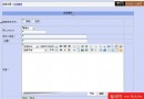
實例圖形:
public void ZoomOut(PictureBox m_PictureBox)
{
ESRI.ArCGIS.Carto.IMapDescription pMapDescription = m_sMapDesc;
IEnvelope pEnvelope = pMapDescription.MapArea.Extent;
double eWidth = Math.Abs(pEnvelope.XMax - pEnvelope.XMin);
double eHeight = Math.Abs(pEnvelope.YMax - pEnvelope.YMin);
double xFactor = (eWidth - (eWidth * 1.5)) / 2;
double yFactor = (eHeight - (eHeight * 1.5)) / 2;
; pEnvelope.XMax = pEnvelope.XMax - xFactor;
pEnvelope.XMin = pEnvelope.XMin + xFactor;
pEnvelope.YMax = pEnvelope.YMax - yFactor;
pEnvelope.YMin = pEnvelope.YMin + yFactor;
IMapArea ma = pMapDescription.MapArea;
IMapExtent pMapExtent = ma as IMapExtent;
pMapExtent.Extent = pEnvelope;
pMapDescription.MapArea = ma;
m_sMapDesc = pMapDescription;
drawMap(ref pMapDescription, m_PictureBox);
}
放大操作的基本原理是取得當前的地圖描述MapDescription,然後按照比例計算出放大或縮小的比例。在得出按照比例計算出來的周邊坐標,然後將其提交服務器,取得圖形進行顯示。